Handling 3D Laser-scanned Resources in tDAR
- James deVos
About
More information about laser scanning process and best practices can be found at: http://guides.archaeologydataservice.ac.uk/g2gp/LaserScan_Toc
Members of the Digital Antiquity can access some sample materials at: \\itfs1.asurite.ad.asu.edu\library$\shares\Project\tDAR\sample data\laser scans
This document covers strategies for how tDAR might handle 3D-scanned materials. Including audience, user workflow, and the potential tDAR modifications necessary to accommodate these types of resources.
3D scanners record and measure precise three dimensional information of a real world object or environment. The informaton is output from the scanner as a 3D point cloud where each point is assigned an X,Y, and Z coordinate. Some scanners also record intensity information (I) and/or color information (RGB). A number of additional datasets can be derived from point clouds including polygonal meshes, CAD files, and others. The recommended format for archiving polygonal meshes is the Wavefront OBJ format. The OBJ format inlcudes 3 files: the object file (.obj) which contain the 3d point data of the resource and material files (.jpg and .mtl) which map to the color of the resource at each point described in the object file). Additional information on other derivative datasets can be pulled from ADS Guide. It is also recommended to archive any images/photographs from a project survey.
CAST uses an excel spreadsheet for defining project-level metadata, as well as documenting details of the scanning and post-processing. It also contains a variable number of records describing the contents of the zip file containing the scanning derivative files.
Audience for 3D Resources
The audience for these resources would be split between:
- Technical archaeological community who will want to work with these objects and inspect workflows and processes
- A more general community who will want to make use of the "result" that is, view the scan, play with the 3d object, perhaps perform measurements
tDAR Workflow
We imagine the data-entry workflow for a tDAR user to work something like this:
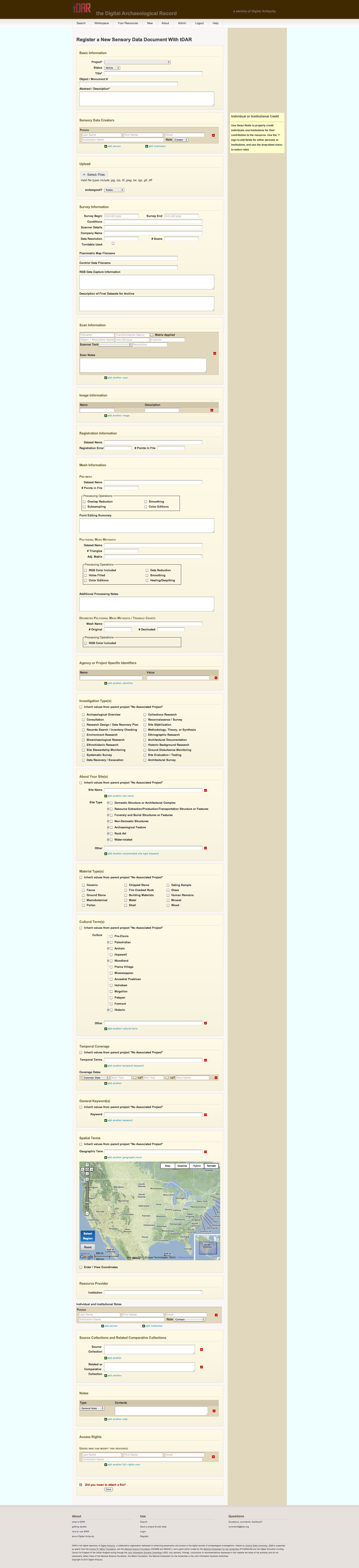
- User enters standard information-resource metadata (creator information, keywords, geographical information, etc)
- User enters sensory data that captures specific metadata agreed upon by CAST and Digital Antiquity that captures all metdata that is not file-specific. Proposal that this would include the following sections of the ADS template:
- Survey / Project Level Metadata
- User uploads files associated with the resource
- One or more reference / display images / objects
- The complete set of scan files in .zip, .tar, or .tgz format. This includes:
- Raw scan data (ASCII point cloud format or possibly NATIVE scanner format depending on source)
- Registered dataset (ASCII point cloud format)
- Additional projects (could be mesh, CAD, etc...)
- tDAR processes the zip file set. Some actions inclue
- For reference images, tDAR will create thumbnails for display on the resource's "view" page.
- For file archives (.zip, .tar, .tgz), tDAR creates a manifest file listing the contents of the archive, and makes this listing available for download on the resource's "view" page.
Once uploaded, tDAR would display a normal record with the technical metadata and display image for the object
Attachments